Two successes and a failure
The successes, a 25 metre wide footpath and a new Greenway
Success No 1. At Merryhill in Bushey, OSS
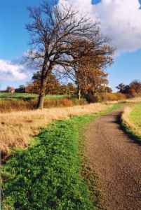
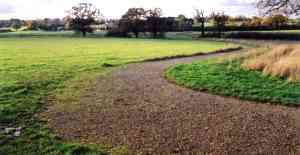
correspondent Chris Beney helped get a brand new Greenway, for foot, horse and
cycle use. The Greenway is at least 6 metres wide throughout, much wider in
parts. Three metres of the six are hardened and the rest is grass. The Greenway
is formally a bridleway. |
 |
| Two views of the Greenway |
Success No 2. Close to that
Greenway our correspondent helped get a 25 metre wide footpath dedicated
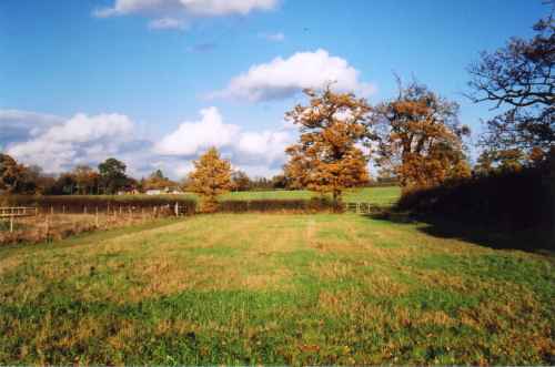
by the Woodland Trust. The original (and Definitive) footpath was to the left of
the photo below and used to be a mid field path. The left-hand fence is new. The
25 metre footpath came about because in 1941 the farmer, Mr Lipscombe, ploughed
up the permanent grass for wheat under wartime direction. He made a path some 25
metres away at the edge of the field (to the right on the photo below) and most
people used that most of the time. Mr Lipscombe did nothing to stop them and so
it became ripe for a Wildlife and Countryside Act claim as an additional path
since over 50 years had passed. The widths of neither path was defined,
but they were probably quite wide.
 The 25m wide footpath (Bushey 17) The field boundary on the left is recent |
The
pre 1941 stile location can just be seen on the left at the end of the
field and the more modern kissing gate (replacing an old stile) on the
right.
The two paths on the other side of the far hedge merge some 50 m further on. |
Some technical details
The OSS local correspondent was working with the Woodland Trust to
lay out and create the Greenway which was to run in places next to the footpath,
and he suggested that Wildlife and Countryside Act claims would very likely
succeed and that with our county's current delay of 10 years in processing such
claims, this would be a problem hanging over everyone for years if not resolved
earlier. So it was agreed to solve the problem by a creation agreement covering
the two paths and all the area between, some 25 metres in all. Because trees are
the purpose of the Woodland Trust, to ensure their agreement a limitation was
written in that trees could be grown on the footpath but not so as to reduce the
width to less than 6 metres. So the usable public path is anywhere between the
trees as well as anywhere along the 6 metre clear strip. In fact the Trust now
plans to leave this area relatively tree free for the present.
| Our correspondent drafted the creation agreement (in close consultation with others especially the BHS) and it was picked up with almost no changes by the Highway Authority. There were many points of note about this whole process and some may be of more general interest: | |
| 1. There was a five foot Gap (or width restriction) near the terminating road in order to keep cars out but provision was made in the creation agreement to allow further restrictions for the safety of legitimate path users, but only if the Highway Authority agrees in writing 'following consultation with user groups representing all legitimate users'. This may prove a useful precedent for future agreements. | |
| 2. At the other end of the Greenway it was felt that an open gap near the road would be too much of an invitation to motorcycles and so a self-closing unlatched two-way bridle gate was put up by the local user group. This gate just swings easily to and fro like a saloon bar door in a Western film, allowing everyone to pass, but it seems to serve its purpose of discouraging motorbikes. | |
| 3. An explanatory note was circulated with the draft giving the reasons for all the less obvious issues on this path and on the adjoining Greenway and including an outline of the historic background. This went to landowner, officer, and user representatives. That was felt helpful, especially with staff changes (the Woodland Trust lawyer and the field officer changed during the process), since many aspects, including the 25m strip, would have been either queried or altered without that background information. | |
Our correspondent says that communication with the Woodland Trust staff has been good.
The failure, a leisure centre on Green Belt
 |
This was green belt land. It became a Leisure Centre. |
On the basis of if you can't beat them join them, the local path user group, BADFA, a parish path partner, had asked for some modest space on the site for gate kit and signpost storage and for a small area inside to be devoted to the Borough's biggest leisure activity of all, walking and riding on public paths. The response was negative.
Surprisingly and unexpectedly, the Minister decided not to call in the planning application for a public inquiry, closing an expected avenue for objection. The local correspondent pursued the matter through the local plan, but in contrast to the considerable success over public paths, failed to get it changed.
top of page
OSS correspondent's page